
Map terrain & drainage
Understand elevation, slope, and low areas to inform water management and field planning.
Field notes, product updates, and mapping insights.
Capture the terrain beneath your decisions. LiDARUSA helps agricultural teams and researchers build a measurable 3D picture of fields, orchards, and changing landscapes.
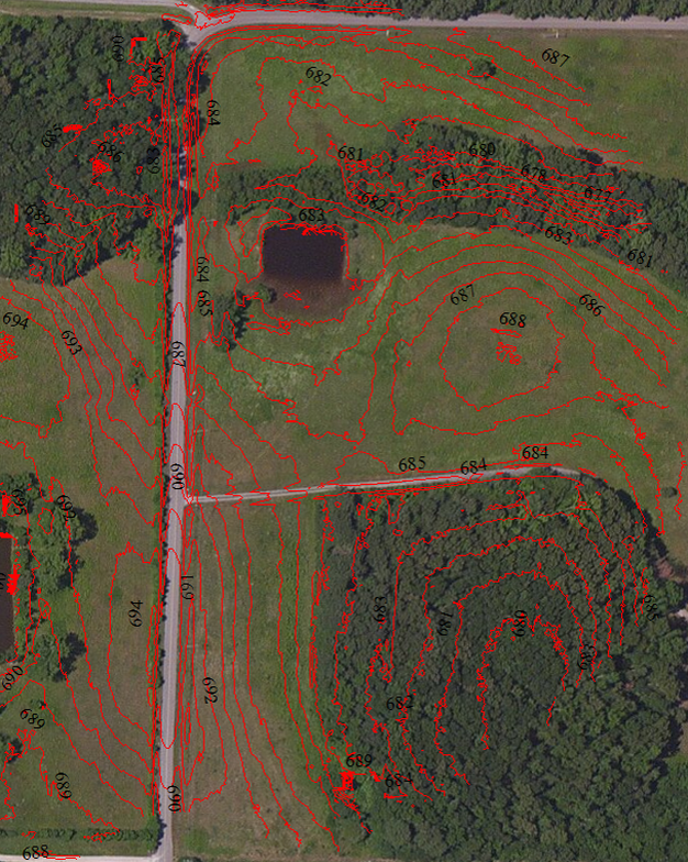
Understand elevation, slope, and low areas to inform water management and field planning.
Build 3D datasets for canopy height, orchard structure, and plant research.
Use repeat surveys to investigate changes in vegetation and the landscape.
We’re proud to have supplied LiDAR systems to organizations across agriculture, industry, conservation, and environmental research.










Logos identify customers and do not imply endorsement.
LiDAR measures distance to create a 3D point cloud. For agriculture, that data can support terrain models, vegetation measurements, and a consistent record of conditions across a site.
Use ground-classified data to develop elevation models and contours. Analyze slope and potential flow paths to support drainage, irrigation layout, and erosion investigations.
Measure vegetation height relative to the ground and explore canopy shape and spacing. Combine LiDAR with imagery to add visual context to field and orchard research.
Compare aligned surveys to study growth, terrain change, or management effects. Consistent capture methods and quality checks make comparisons more useful.
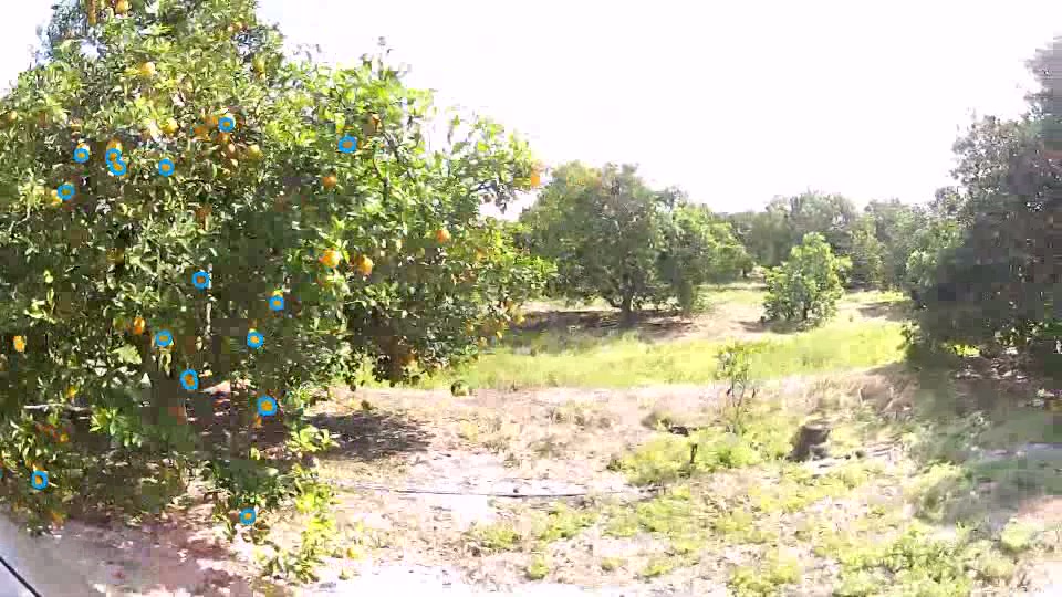
LiDAR describes the geometry of the scene. Camera imagery adds the visual detail that helps teams interpret it.
Our earlier orchard demonstration explored identifying visible fruit in imagery. Today’s project should start with the question you need to answer—then match the sensors, collection plan, and analysis to it.
Fruit detection is an imagery-analysis task. Counts and yield estimates need application-specific validation; they are not automatic LiDAR outputs.
Tell us your acreage, crop or landscape, target measurements, required accuracy, and preferred collection platform. We’ll help you define a practical configuration.
Decide whether you need bare-earth terrain, canopy measurements, imagery, or a repeatable research dataset.
Choose UAV, vehicle, or another supported setup around access, coverage, vegetation, and operating constraints.
Georeference, align, classify, and check the point cloud before generating surfaces or measurements.
Bring the results into your GIS, engineering, or research workflow and validate them against field observations.
LiDAR can map field elevation, support drainage and irrigation planning, measure vegetation structure, and document change through repeat surveys. The deliverables depend on the sensor, collection plan, processing, and field conditions.
Some laser pulses can reach the ground through gaps in vegetation. Ground coverage depends on canopy density, viewing geometry, and collection settings. Dense vegetation can leave gaps that require a different survey plan or additional ground measurements.
A camera is useful when your team needs visual interpretation alongside 3D measurements. RGB imagery can support a colorized point cloud when correctly aligned; crop-health research may call for additional sensors and a separate analysis workflow.
The best fit depends on acreage, terrain, vegetation, accuracy requirements, collection platform, and budget. Start with the required deliverable, then select a LiDAR sensor, positioning system, and optional camera that can support it.
Tell us about your land, your research, and the decisions your data needs to support. Let’s build a LiDAR solution around your work.